GLIMS: Global Land Ice Measurements from Space

Monitoring the World's Changing Glaciers

GLIMS Workshop 2008, Boulder, Colorado, USA

For the original announcement and information page, see here.

GLIMS Workshop

Boulder, Colorado

June 16-18 (Monday-Wednesday), 2008

Duration: 2.5 days (half day on Day Three)

Through this workshop we sought to review and advance the current state of knowledge regarding several key topics that are of direct relevance to glacier studies based on remote sensing. These are:

  1. DEM generation from satellite stereo pairs

  2. Mapping ice divides

  3. Mapping debris covered glaciers

  4. Challenges in assessing change through comparisons with older data

  5. Other major hurdles in satellite glacier mapping


Workshop participants were invited to make presentations that addressed specific questions related to one or more of these topics, such as:

  1. What are the best tools and methods for the problem? How can these be best shared with the GLIMS community?

  2. Where are the main problems? What steps need special attention?

  3. What additional methods or algorithms need to be developed?

  4. Can we agree on specific protocols, definitions or procedures to help the GLIMS community deal with this topic?

  5. What additional assistance can be provided to help make dealing with this topic easier for others in GLIMS?

This workshop addressed GLIMS-specific issues mostly at the technical level. By contrast, the International Workshop on World Glacier Inventory, to be held in Lanzhou, China, 20-24 September 2008, will focus on the broader issues of coordinating different glacier inventory efforts, how these efforts tie into larger Earth observation programs, and how best to achieve global coverage soon.

Participants

Group Photos


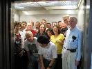
On the way to the roof for a group photograph.


Group photograph from the roof of NSIDC.

Participant List

  • HTML
  • PDF

Program

Pre-workshop hike

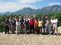
On the Sunday before the workshop, five of us went hiking in Rocky Mountain National Park. Pictures

Day One

  • Liss Andreassen: Area changes from multiple glacier inventories in Jotunheimen, Norway ( PDF for GLIMS affiliates )
  • Tony Schenk: Glacier inventorying using historical photographs (polar regions) ( PDF for GLIMS affiliates )
  • Bruce Molnia: Delineating Afghanistan's glaciers and problems dealing with debris-cover ( PDF for GLIMS affiliates )
  • Frank Paul: glacier mapping from different sensors - technical and methodological challenges ( PDF for GLIMS affiliates )
  • Adina Racoviteanu- Debris cover mapping in the Sikkim Himalaya from ASTER data ( PDF for GLIMS affiliates )
  • Silvia Delgado: Mapping ice divides and comparing w/ old data (Argentinian glaciers) ( PDF for GLIMS affiliates )
  • Tobias Bolch/R.Wheate/B.Menounos: Mapping of ice divides and Challenges in assessing change through comparisons with older data (British Columbia glaciers) ( PDF for GLIMS affiliates )
  • Jeff Kargel: Glacier lake mapping and debris cover ( PDF for GLIMS affiliates )
  • Focus groups:
    Group 1: Clean ice and lake mapping;
    Group 2: Debris cover mapping;
    Group 3: Ice divides; ( PDF for GLIMS affiliates )
    Group 4: Inter-inventory comparison and change analysis;

Day Two

  • Bruce Raup: Image selection and pre-processing, GLIMS status ( PDF for GLIMS affiliates )
  • Siri Jodha: ASTER-Derived DEMs for Glacier Studies: Comparison of Four Commercial Software Packages ( PDF for GLIMS affiliates )
  • Don Atwood: Evaluation the vertical accuracy of ASTER DEMs vs. NED DEMs using ICESat/ALOS PRISM DEM's ( PDF for GLIMS affiliates )
  • Roger Wheate/B.Menounos: Comparison of DEMs from different sources ( PDF for GLIMS affiliates )
  • Bruce Raup: GLIMS Demonstrations (demos of GLIMSView, GLIMS online tools, and interfaces to the GLIMS Glacier Database.)
  • Adina Racoviteanu: Post-processing issues in GIS (DEMs, error analysis etc)- demo ( PDF for GLIMS affiliates )
  • Dorothy Hall: Greenland surface temperatures ( PDF for GLIMS affiliates )
  • Kitayama Tomoaki: Ice Flow Measurements by Using Satellite images on Shirase Glacier in Antarctica ( PDF for GLIMS affiliates )
  • Michael Zemp: The compilation of a world inventory of glaciers and ice caps -- present status and future challenges ( PDF for GLIMS affiliates )
  • Focus groups:
    Group 1: DEM generation, comparision and analysis; ( PDF for GLIMS affiliates )
    Group 2: Glacier elevation change detection; error analysis; ( PDF for GLIMS affiliates )

Day Three

  • (synthesis and discussion)

Workshop Results

The results of the workshop will be compiled into a report, with intent to submit it for publication. In addition, a section of the www.glims.org Web site will show the results of these working groups and disseminate algorithms and computer code. This work is still in preparation.